 AAPA Seaports
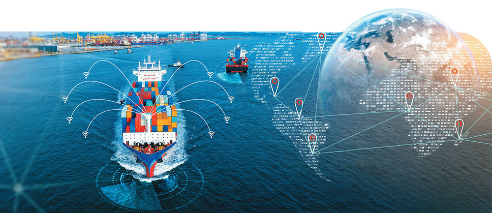
Maritime trade volume may have declined slightly in 2022 from the previous year, but don’t let that single statistic fool you. The United Nations Conference on Trade and Development expects maritime trade to see sustained growth in the coming years, making it imperative that port authorities boost their operational efficiencies to deal with increased volume.
The UNCTAD’s 2023 Review of Maritime Transport found that international seaborne trade volume dipped 0.4% to 12.027 million tons in 2022, driven by weaker-than-expected economic growth, high inflation that impacted consumer spending, Russia’s invasion of Ukraine, and strict COVID-19 containment measures primarily affecting the Chinese economy.
But a single year doesn’t constitute a trend, and in fact, 2022 should prove to be an outlier. Maritime trade volume was expected to increase 2.4% in 2023, followed by annual increases of about 2.1% through 2028, the UN report said.
In response, port authorities and their stakeholders are taking a holistic approach to boosting capacity, embracing technology to streamline operations, and allocating capital toward those infrastructure projects that will provide the biggest impact. Ports and their stakeholders also are working to share data in real time to optimize asset utilization and avoid wasting time and money.
Through sophisticated software systems and upgrades to physical infrastructure, port authorities are working to improve supply chain resiliency, increase throughput and expand operations in the smartest way possible, unlocking the full economic potential of ports.
In some cases, technology is enabling ports to analyze every aspect of their operations to boost capacity without expanding their physical footprint. In other cases, software is allowing ports to determine the best way to develop their unused acreage, augmenting their contributions to the local, regional, and global economies.
Planning Upgrades
In November, the U.S. Department of Transportation’s Maritime Administration announced more than $653 million in grants to fund 41 port improvement projects under the Port Infrastructure Development Program. Those investments are part of the largest dedicated funding initiative for ports and waterways in history – almost $17 billion – through the 2021 bipartisan infrastructure bill, according to the White House.
But getting funding for port improvement projects is only part of the challenge facing port authorities, according to Vijay Agrawal, vice president of goods movement at AECOM, a leading global infrastructure consulting firm.
Ports must obtain input and approval from a variety of local, state, and federal agencies before moving forward with infrastructure projects – a laborious process that can delay the economic benefits of port upgrades.
To streamline that process, AECOM developed PlanEngage, powered by Esri’s ArcGIS Online software. Esri is the global market leader in geographic information system (GIS) software.
PlanEngage is an interactive, cloud-based platform that accelerates the planning and stakeholder engagement process throughout a project’s lifecycle by communicating complex information in an easily accessible, digital format.
The platform allows infrastructure owners, engineers, and design professionals to create and explore digital models of realworld locations using real-time spatial data, 3D models, sensors, satellite imagery, and other technology. By adjusting those models to various scenarios, port authorities can make better-informed decisions and maximize the impact of port improvement projects, Agrawal added.
PlanEngage enables project teams to collaboratively create, edit and publish highly visual and interactive information, including multimedia, 360-degree photos, visualizations, and project dashboards. Mobile-friendly communication tools allow community members to review projects from smart devices at any time.
By increasing collaboration and transparency, port authorities can eliminate unnecessary delays and ensure that project milestones are met on time and on budget. Agrawal said that with the largest cargo vessels now capable of carrying 25,000 containers, ports need enhanced planning capabilities to get the most out of their infrastructure spending.
“PlanEngage is built around the premise that time is money, and time lost is money lost,” Agrawal said. “The platform creates reports for the agencies to review, crosscheck and provide their feedback on, so it provides an ecosystem for all the stakeholders to work more efficiently. Efficiency is the name of the game.”
Similarly, ports are working to upgrade their legacy workflow systems, which often still involve sharing information through spreadsheets, emails, and even fax machines, according to Rafael Fernandes, ports account manager at Esri.
By implementing GIS software, port executives can gain a comprehensive picture of what’s happening at their facilities and share that information with tenants and partners to improve operations, he said. Global shippers can track the movement of their freight in real time, and ports can monitor environmental factors that impact operations.
“The idea is to connect their systems together and build new technological processes,” Fernandes said. “That’s what GIS is all about – overlaying your data on a map to be able to understand what’s happening in your jurisdiction over space and time. It provides a common operational picture so I can see everything that’s going on at the port.”
As an example, Fernandes pointed to sensor-equipped buoys that track tides, winds, salinity and wave action so vessels can enter ports only when conditions are suitable. Using GIS software, ports can coordinate vessels’ arrival and departure times to optimize manpower and equipment usage.
The push toward greater efficiency will improve traffic management, increasing throughput and reducing emissions associated with vessels, trucks, and other port operations. GIS software is part of a broader effort to streamline operations that includes scheduling arrival and departure times for trucks and stacking containers according to that schedule.
“Port executives are asking, ‘How do I bring all of these moving pieces together in a coordinated fashion to optimize my throughput?’,” Fernandes said. “hat’s the challenge that the major ports are undertaking now, and we see GIS as being the glue between all these different stakeholders because it’s a common technology platform and language.”
Terry Bills, global transportation industry director at Esri, said GIS software promises to reduce bottlenecks that impede the flow of goods, especially during handoffs from vessels to rail or truck and vice versa. GIS software also is helping ports to determine the optimal mix of facilities at their port, a key consideration for ports tasked with increasing throughput without expanding geographically, he said.
“Port authorities are tackling that from the maritime side as well as the land side, seeking better coordination and collaboration between all the actors within a port, whether it’s the railways or trucking and drayage firms,” Bills said. “Everyone in the port community needs to come together to increase efficiencies in the supply chain, and I think ports around the world now recognize that.”
A Multipronged Approach
Of course, boosting throughput and expanding operations comes with some growing pains, but in the long run, wellplanned investments in port infrastructure are worth it, according to Griff Lynch, president and chief executive of the Georgia Ports Authority.
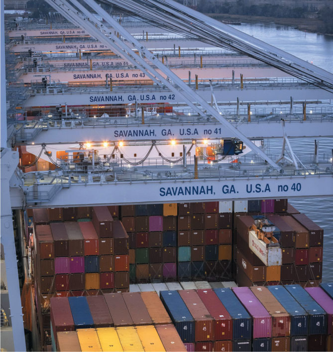
GPA is in the midst of a 10-year, $4 billion port master plan aimed at solidifying the Port of Savannah’s status as a major hub, he said. In August, the Port of Savannah handled 413,300 TEUs, down 28% from August 2022, the busiest month in GPA history, partially because some of its berths were being rebuilt, which reduced its operating capacity.
“These improvement projects do have short-term negative impacts to operations, but once they’re done, you’re really glad you did them,” Lynch said. “You quickly forget about the pain you went through, and you’re grateful that you took the necessary steps to secure your port capacity for years to come. We’re preparing to handle those 20,000-TEU vessels. That’s our focus because you have to be in the big-vessel game if you’re going to be a gateway port.”
A major component of GPA’s master plan is the Mason Mega Rail Terminal, which is now fully operational after five years of development work. Sitting on 85 acres at the Port of Savannah, it’s the largest on-terminal intermodal facility in North America.
GPA and CSX are working together to provide rail departures seven days a week between the Mason Mega Rail Terminal and the railroad’s CCX Yard in Rocky Mount, N.C. The Carolina Connector direct rail service offers customers threeday transit time from vessel discharge to cargo availability.
Savannah’s position as a first port of call for ocean carriers transiting the Panama Canal means cargo will be available at CCX before containers could even be unloaded from a vessel at ports farther up the coast, Lynch said. The rail service benefits ocean carriers by allowing them to avoid the socalled milk run, in which large vessels must visit several ports in a row to unload cargo, he added.
The infrastructure upgrades at GPA are numerous and impactful. Renovations at the Port of Savannah’s Container Berth 1 were completed in August, providing another bigship berth option and allowing the Garden City Terminal to simultaneously serve seven ships, including four vessels with a capacity of larger than 16,000 TEUs. Annual berth capacity has increased by 1.5 million TEUs, Lynch said.
GPA ordered eight new ship-to-shore cranes, with the first four arriving last February. The remaining four arrived in September and were scheduled to be operational in January.
Renovations to the Port of Savannah’s 200-acre Ocean Terminal will allow it to serve two large container ships simultaneously, offering an annual capacity of 2 million TEUs. Eight additional cranes have been ordered as part of that project. Renovations to the first berth will be completed in 2025, with the second completed in 2026, Lynch said.
Georgia Ports is also establishing its new Garden City Terminal West to add 1 million TEUs of annual storage capacity when completed in phases through 2024. Fifteen electric rubber-tire gantry cranes will serve the 100-acre site.
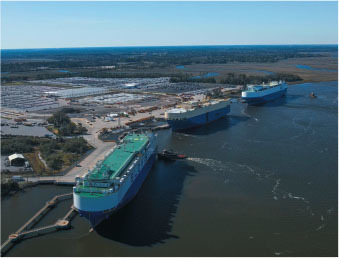
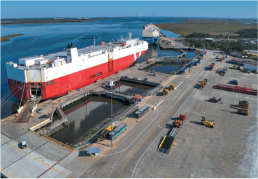
In addition, GPA is expanding capacity to serve growing roll-on, roll-off cargo volumes at the Port of Brunswick. GPA is developing 640,000 square feet of new processing space, 122 acres of additional auto storage and a fourth Ro/Ro berth at Colonel’s Island, increasing Ro/Ro capacity to 1.4 million vehicles per year from 1.2 million.
Aside from facility upgrades, GPA is also investing in its workforce. The GPA Savannah Area Workforce Housing Initiative has pledged to contribute $6 million over eight years to Housing Savannah Inc., which will provide affordable housing to port employees and the broader community. The initiative aims to build, repair and purchase affordable workforce housing to benefit low- and moderate-income homeowners, first-time homebuyers and renters, increasing the pool of workers available to the port.
“We can improve our port facilities all we want, but if we want to grow, we’ll need to have that workforce, so we’re putting our money where our mouth is,” Lynch said.


